Sometimes you work on something so hard for so long you actually miss the point where it became, for lack of a better word, “usable”. There’s this idea in software development of the minimum viable product, which in my opinion isn’t the same thing as the minimum useful feature set, but there’s probably some debate. The first […]
Continue readingTag Archives: Geospatial
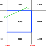
Cohen-Sutherland Line Clipping in C#
While busy working on TrueNorth, I implemented this based on the the Wikipedia Article. The Extents class, and the PointDType are simple structures to contain the view window, and the double precision coordinates respectively.
Continue readingQuadTree
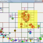
Introduction A QuadTree is a spatial partitioning strategy used to make queries on relationships between 2D spatial data such as coordinates in a Geographic Information System (GIS), or the location of objects in a video game. For instance, you may need to know all the objects within a region on a map, test whether objects are visible by […]
Continue reading

